It’s the most extended road trip to Perth Adelaide, which means you’re not only across the state border but also driving for many hours. However, if you dare to challenge this route map, you will get a milestone in your life.
Driving Perth to Adelaide is one of the great road trips in Australia; arrange many beautiful places midway as you would. This article will talk about how to plan a road trip on a budget.
Before You Take Action
I must say that I haven’t been to every attraction on this road. So here I just tried some practical recommendations for road trips by my friends & residents and wrote itineraries using my experience as suggestions.
You don’t need to follow my whole plan; arrange it, add and remove some places in your mind and consider your limited day & budget. Then, hopefully, you will enjoy a fun fill & unforgettable road trip of your own!
Perth Adelaide Drive Route Map Overview
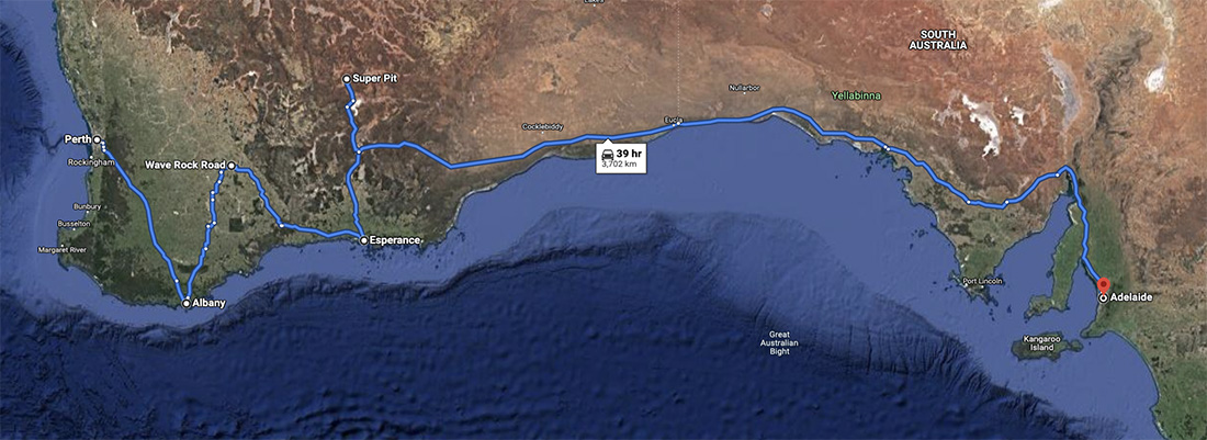
How Many Kilometers Is This Route?
That’s the most extended road trip in Australia, 3837 km, across the border of Western & South Australia. Perth is in Western Australia, and Adelaide is in South Australia.
However, the total length of Perth to Adelaide is nearly 4,000 kilometers, which is almost impossible for self-driving for many short-term tourists. Why do I say this?
Unless you are a resident or a truck driver, this long-distance driving journey consumes your fuel costs and car parts.
How Many Days Are Best For A Road Trip?
3837 km as a result on this route map that takes at least 40 hrs drive, no one could do that in a single day I know. So the important is that you have to prepare yourself cause you need lots of energy for a long time driving, and make sure you have a great physical body.
It means 40 hrs must be shared at least one week on average of 6-7 hrs drive time in a day. Also, face any situation which appears midway, so make sure you can hold on to that.
If you are willing to take this road trip for one week, that’s pretty cool. Then let’s see what attractions you can add to the plan.
Or, you may not want to go to Adelaide, then I will share another Western Australia self-driving advice trip with you.
Best Attractions Between Perth & Adelaide
I have to say, not every attraction that I have been to, I just tried to put forward those well-received attractions from Google Map and Trip Advisor, and making this list:
- Perth City (City Tour)
- Busselton Jetty
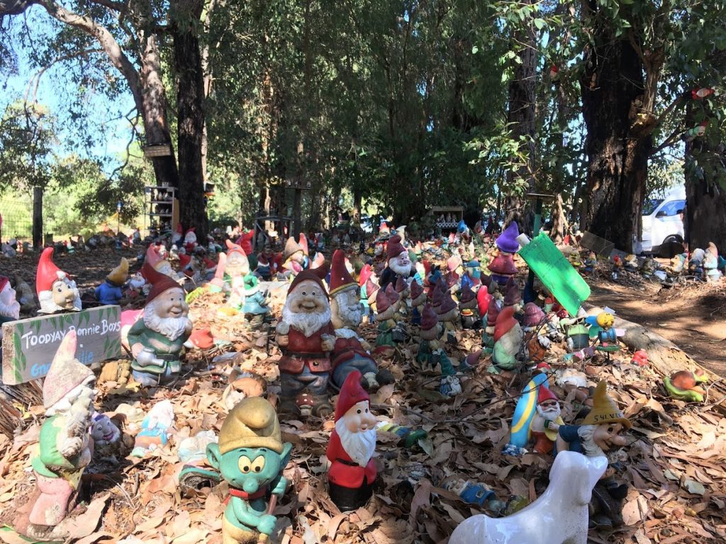
- Gnomesville
- Ngilgi Cave
- Canal Rocks
- Mammoth Cave
- Lake Cave
- Jewel Cave
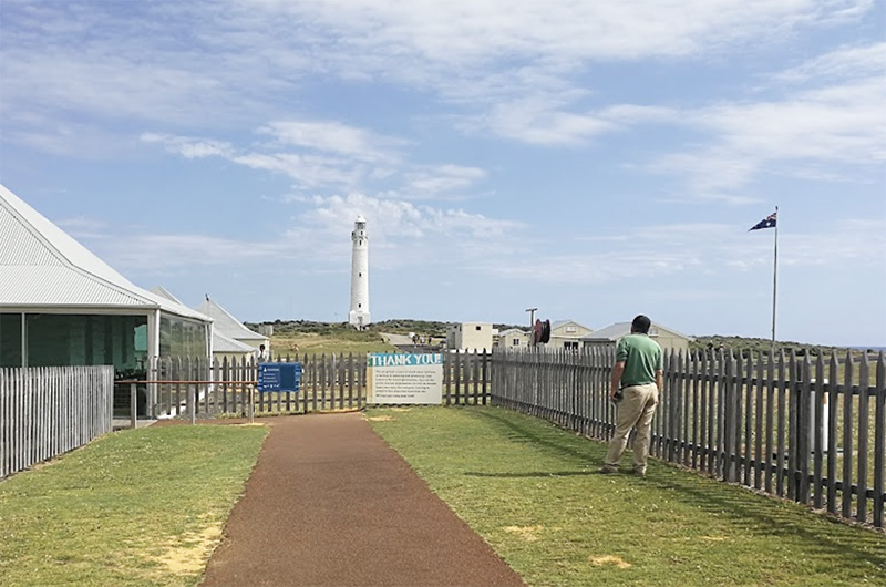
- Cape Leeuwin Lighthouse
- Gloucester Tree
- William Bay National Park (Elephant Cove, Greens Pool, Waterfall Beach, Madfish Bay)
- Nature Bridge
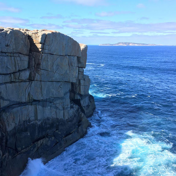
- The Gap
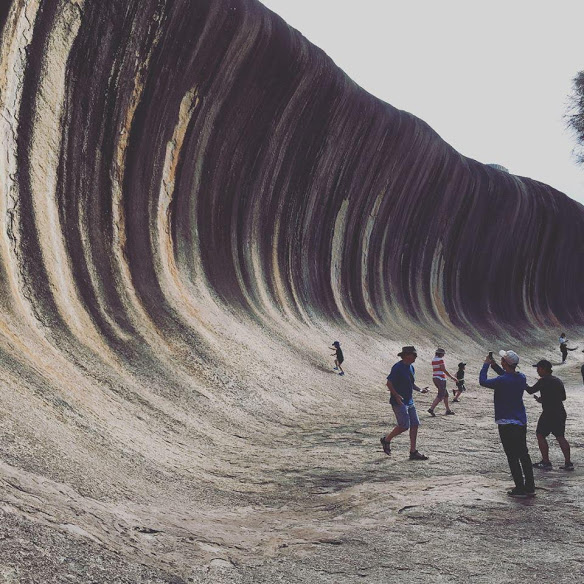
- Wave Rock
Check Over 32 Up Attractions between Perth & Adelaide>>
1 Week Itinerary Perth Adelaide Road Trip
Above all the attractions list and my previous travel experience, I took a road trip that drove from Perth to Adelaide in 9-10 days. After a city tour in Perth, go to Albany through Busselton in one day.
I’m a faster driver; you don’t need to take that driving trip like me; it’s your vacation so take your time, relax. So here is the itinerary that I suggest:
Day 1 – Perth to Albany
- Estimated Distance – 605 km
- Estimated Drive Time – 7 hr
>>Get Navigation on Google Map
In this part route, you have these places drive-through:
- Gnomesville – Our first attraction after Perth, where a special place piles many tiny dolls & toys here, made me think about the Blue Elf cartoon.
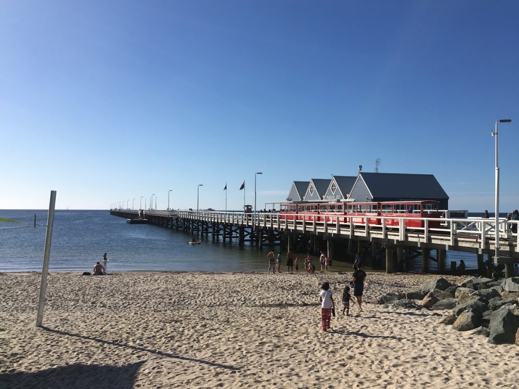
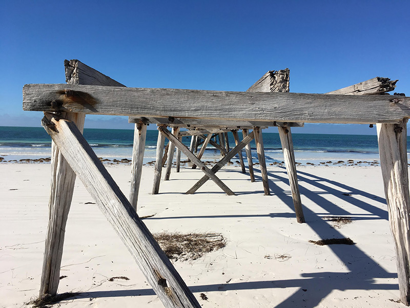
- Busselton Jetty – The longest jetty in Australia, you need to reach the end by taking their tour train or walking. We just take a break, have lunch then leave.
- Nannup (Optional) – A small town for taking a break, it can add several attractions to your route plan.
- Gloucester Tree (Optional) – It’s interesting because I like rock climbing. When I saw several giant trees with steel ladders & woody houses, I felt excited, but my partner didn’t interest me. We just drove through and didn’t go in. You can add this to your plan if you like.
- Walpole (Optional) – This is our stay night because it’s already night time we were here. We stayed at Tingle All Over Budget Accommodation. There’s a giant tree scene near the backpackers if you’re interested.
- Albany – It’s our next destination this day, but it’s too late to drive for us. If you ignore attractions from Perth and head to Albany, it should be fine.
Leave Perth City, drive to Gnomesville and then Busselton Jetty, drive & stay over in Albany.
Day 2 – Albany to Ravensthorpe
- Estimated Distance – 577 km
- Estimated Drive Time – 6 hr 30 min
>>Get Navigation on Google Map
In this part route, you have these places drive-through:
- The Gap – It’s a nice place; there’s a platform you are standing on, and you can see the giant wave under you, excited!
- Natural Bridge – This place is naturally shaped near The Gap by walking, but you cannot climb on that bridge; look.
- Pingrup – A small town lets you take a break, have lunch, fill fuel and keep moving.
- Lake Grace (Optional) – Another place you can take a break.
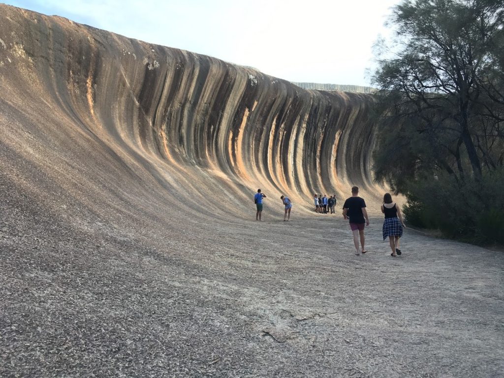
- Wave Rock – It’s a stunning place, natural wave-shaped, everybody tries to set pose or climb (Never climb); worth staying here for one night. Many caravan parking companies choose here for stay.
- Lake King (Optional) – A small town that lets you take a break.
- Ravensthorpe – A place that enables you to take a break & have lunch, fill fuel, and keep moving.
Albany tour, Nature Bridge & The Gap, then drive to Wave Rock, stay over in Ravensthorpe.
Day 3 – Ravensthorpe to Esperance
- Estimated Distance – 336 km
- Estimated Drive Time – 4 hr 20 min
>>Get Navigation on Google Map
In this part route, you have these places drive-through:
- Esperance – This Is our destination for one more day because we want to visit some fantastic attractions. But before that, we stayed at Esperance Bay Holiday Park, an excellent caravan motel.
- Esperance Stonehenge – Like UK Stonehenge, this is artificial, a farm place we visited before Lucky Bay.
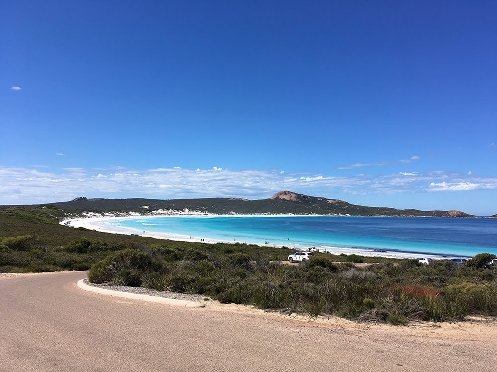
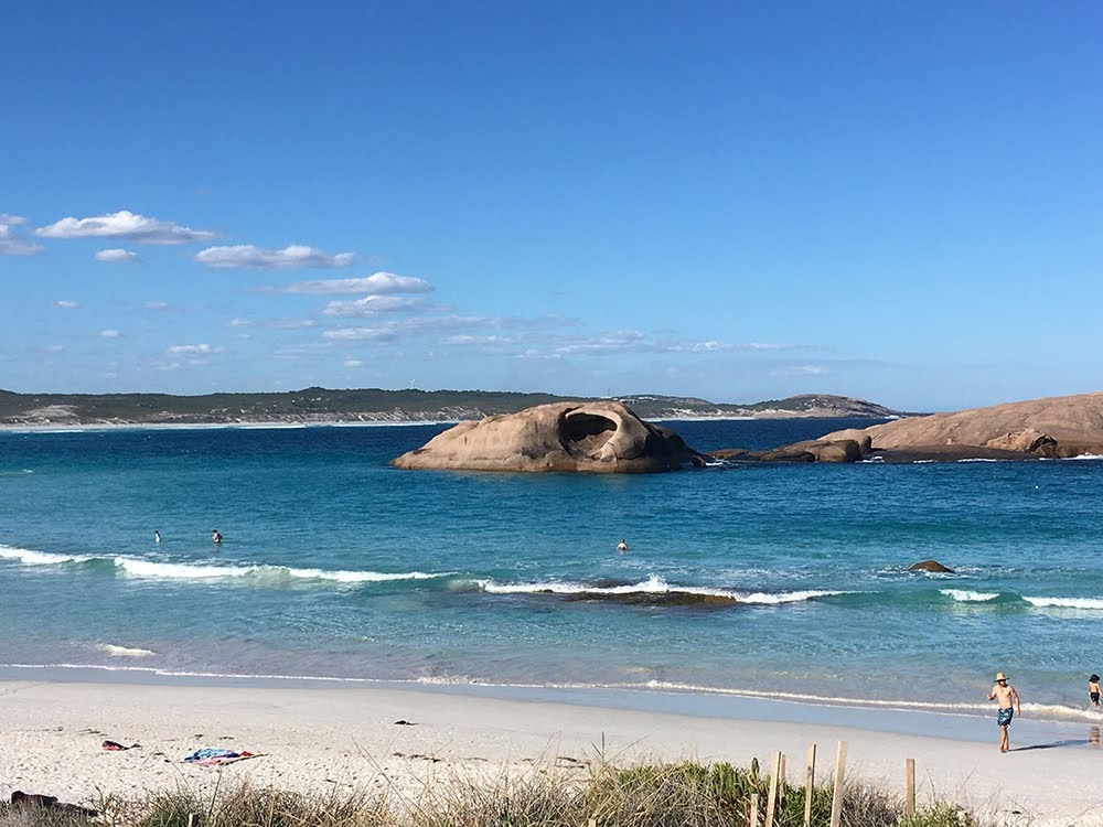
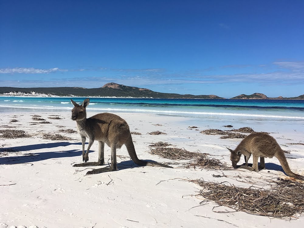
- Lucky Bay – This’s the central axis of our journey today, so aqua, light blue ocean. And total white sand beach like heaven you have never seen before. We stayed here for 2-3 hours and had bbq lunch.
- Twilight Cove – It’s a naturally shaped rock close to the beach with a blue ocean.
- Blue Heaven – Another seaside near Twight Cove, great view.
- Rotary Lookout – A platform you can see the whole coast and chill.
- Pink Lake – It’s our final attraction for a day trip, unfortunately not pink color & entire lake. We just take photos for the mirror effect.
Go to Esperance Stonehenge, then to Lucky Bay for play water. Next, twilight Cove, Blue Heaven Beach, Rotary Lookout Esperance, go to Pink Lake Esperance for sunset, then stay over in Esperance.
Day 4 – Esperance to Kalgoorlie to Norseman
- Estimated Distance – 584 km
- Estimated Drive Time – 6 hr 15 min
>>Get Navigation on Google Map
In this part route, you have these places drive-through:
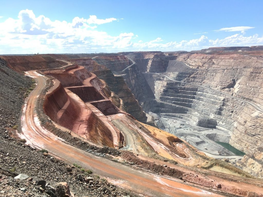
- Super Pit – It’s a whole giant mining site in Kalgoorlie that we have never seen before; it’s our first look at a mining site. If you want to visit there, don’t try to pass the main thru (Access denied by their door guard). Just turn to KCGM Super Pit Lookout and enjoy the mining site view.
- Kambalda (Optional) – There’s a vast salt lake Lake Lefroy near this town and another mining site nearby. Still, you cannot enter, just go to Red Hill Lookout and have a look if you are interested.
- Norseman – This town is the first touch in this day trip, but we just drive through in the morning and back here for a night. We stayed at Bottlemart Express – Norseman Hotel.
Go to Kalgoorlie for the Super Pit mining site, then head south to stay in Norseman.
Day 5 – Norseman to Eucla
- Estimated Distance – 713 km
- Estimated Drive Time – 7 hr 30 min
>>Get Navigation on Google Map
In this part route, you have these places drive-through:
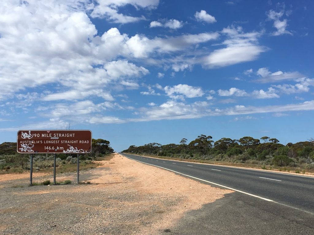
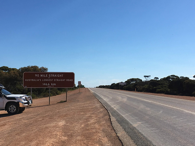
- Balladonia – It’s the only rest point for most drivers, filling fuel, taking a break, and having lunch. After that, prepare to head to STRAIGHT.
- West End of “90 Mile Straight” – This’s a point like the Most Straight Highway in Australia; you can take a photo with this billboard, then get started focusing! (Remind: Always keep awake for your driving cause it’s all straight!)
- Caiguna (Start 90 Mile Straight from East) – 90 miles straight end for us after about one more hour of driving, slow down and stop near the billboard. Retake photos and be careful of those road trains if you want to stand on the highway center.
- Cocklebiddy (Optional) – This place lets you take a break.
- Madura (Optional) – It’s another point that lets you take a break.
- Mundrabilla (Optional) – Another point is to let you take a break. If you want to stay the night earlier, consider this point to your Australia road trip plan.
- Eucla – It’s our final destination on this day; it was turned to evening sky when we arrived. Also, we didn’t see any vehicles frequently on this highway; most drivers called it “Alone Highway.” We stayed at Eucla Motel.
Leave Norseman, drive through Most Straight Highway in Australia until to Eucla.
Day 6 – Eucla to Streaky Bay
- Estimated Distance – 615 km
- Estimated Drive Time – 6 hr 50 min
>>Get Navigation on Google Map
In this part route, you have these places drive-through:
- SA/WA Border Crossing – This’s a border checkpoint for anyone who enters the WA from SA; we just leave WA without a check.
- Great Australian Bight (Border Village SA) – It’s a lookout that lets you see how great the coast of Australian Bight is; stunning but scary height. They set short, tall fences you still can have a look at it. Beware of your speed cause you easily miss that turn.
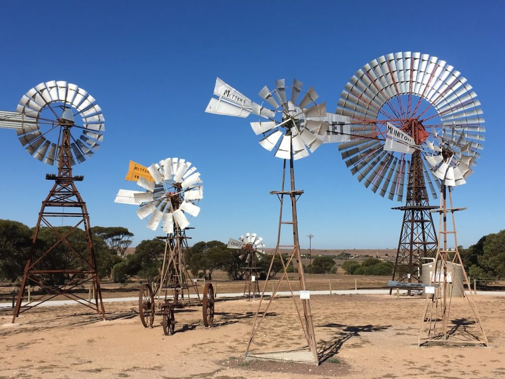
- Penong Windmill Museum – This’s an exciting place to collect various windmills here; also, we take a break and have lunch.
- Ceduna (Optional) – A small town that lets you take a break if you need.
- Streaky Bay – This’s a beautiful port bay as our day road trip destination.
Visit Old Eucla Jetty, leave Eucla, and pass the border of WA/SA through Australia Bight. In addition, enjoy the stunning coast view, visit Penang Windmill Museum, and then stay over in Streaky Bay.
Day 7 – Streaky Bay to Adelaide
- Estimated Distance – 809 km
- Estimated Drive Time – 9 hr 10 min
>>Get Navigation on Google Map
In this part route, you have these places drive-through:
- Murphys Haystacks is a naturally shaped rock pile that looks like a dinosaur egg. Carved by wind erosion for a long time, free entry.
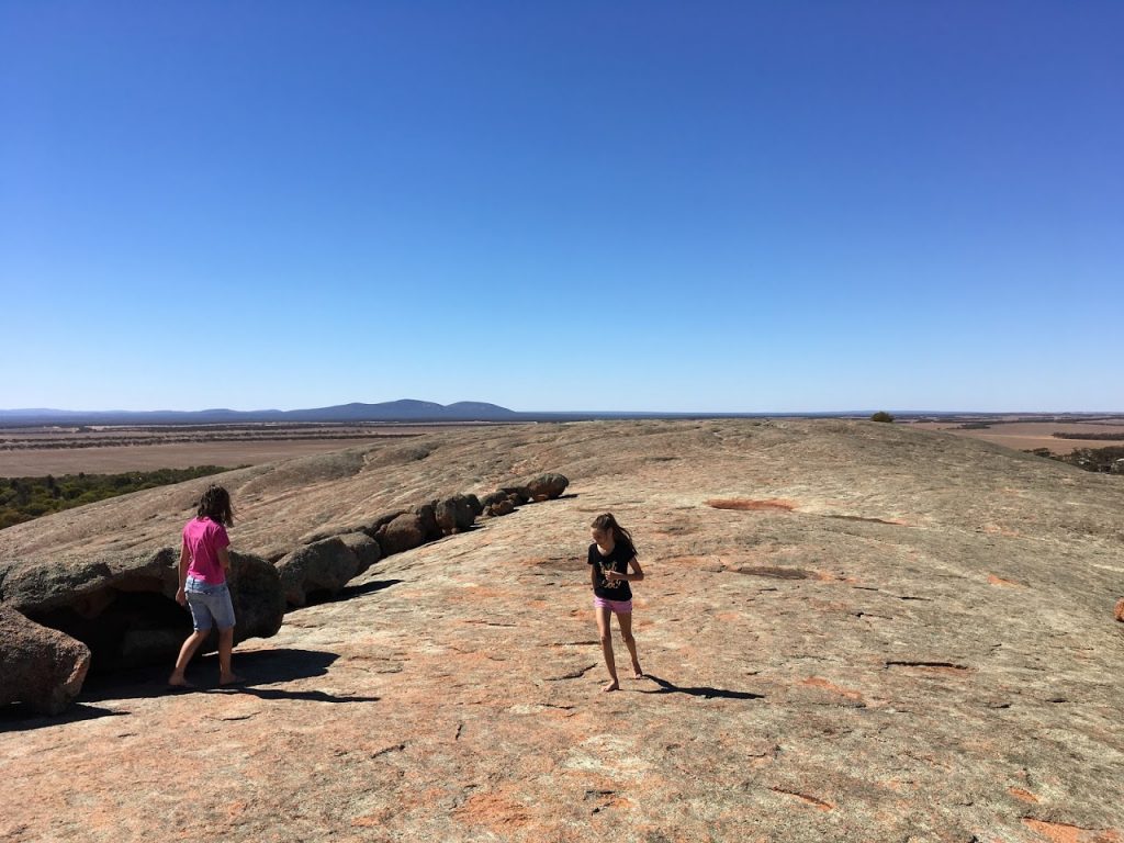
- Pildappa Rock – It’s a giant rock similar to Ayers Rock (Uluru). You can climb to the top and be careful of the scary height and free entry.
- Minnipa (Optional) – A small town that lets you take a break and have lunch.
- Kyancutta (Optional) – A small town that lets you take a break.
- Kimba (Optional) – Another small town that lets you take a break.
- Port Augusta – After several hours of driving, we almost went back to this town, this circle from western, we finished the main route of our road trip. You can consider staying here for the night or keep moving back to Adelaide.
- Crystal Brook (Optional) – A small town lets you take a break before entering the city.
- Adelaide City – We visited here again but stayed at North West Adelaide Port Adelaide Backpackers, the cheapest self-service facilities. What about city tours? Well, it’s the next day.
Go for a visit to Murphys Haystacks & Pildappa Rock, rest at Port Augusta, and finally arrive at Adelaide City. This drive itinerary is the fastest, considering your budget wants to save money, suitable for budget travelers even if it’s not a top trip plan. I’ll show more details in the next couple of days.
2 Weeks Itinerary Perth Adelaide Road Trip
Two weeks plan means you can take your time for driving, not faster but enjoy more of these attractions, let’s check the details:
Day 1 – Perth to Busselton
- Estimated Distance – 270 km
- Estimated Drive Time – 3 hr 10 min
>>Get Navigation on Google Map
In this part route, you have these places drive-through:
- Gnomesville
- Busselton
Leave Perth City, drive to Gnomesville and then Busselton Jetty, and stay over in Busselton.
Day 2 – Busselton to Northcliffe
- Estimated Distance – 303 km
- Estimated Drive Time – 4 hr 10 min
>>Get Navigation on Google Map
In this part route, you have these places drive-through:
- Ngilgi Cave
- Canal Rocks Bridge
- Cape Leeuwin Lighthouse
- Gloucester Tree
- Round Tu-it Eco Caravan Park
Several caves in the southwest include Ngilgi Cave, Mammoth Cave, Lake Cave, and Jewel Cave, and it seems that you only have to choose one should be fine. So what I prefer the cave is Ngilgi Cave because it’s one of the most famous & nearest Canal Rocks.
Drive to Ngilgi Cave first, then go to Canal Rocks, enjoy photography, and then go to Cape Leeuwin Lighthouse, the southwest point of mainland Australia. Then, go to Gloucester Tree and have fun with tree ladders. After that, stay over in Northcliffe. There’s a camping ground Round Tu-it Eco Caravan Park.
Day 3 – Northcliffe to Albany
- Estimated Distance – 178 km
- Estimated Drive Time – 2 hr 30 min
>>Get Navigation on Google Map
In this part route, you have these places drive-through:
- Greens Pool
- Denmark
Go to William Bay National Park, visit Elephant Cove, Greens Pool, Waterfall Beach, Madfish Bay, etc. Elephant Cove is a unique attraction that naturally formed rocks worth being, then camping overnight at Denmark Ocean Beach Holiday Park or going to Albany.
Day 4 – Albany to Wave Rock
- Estimated Distance – 440 km
- Estimated Drive Time – 5 hr 5 min
>>Get Navigation on Google Map
In this part route, you have these places drive-through:
- Albany
- Wave Rock
Visit Nature Bridge & The Gap in Albany, drive to Wave Rock, and stay in Wave Rock.
Day 5 – Wave Rock to Esperance
- Estimated Distance – 404 km
- Estimated Drive Time – 4 hr 14 min
>>Get Navigation on Google Map
In this part route, you have these places drive-through:
- Ravensthorpe
- Esperance
Leave Wave Rock, go to Esperance, loading food & drink. Go to Twilight Cove, Blue Heaven Beach, Rotary Lookout Esperance, Pink Lake Esperance in the sunset, then stay over in Esperance.
Day 6 – Esperance to Lucky Bay
- Estimated Distance – 64 km
- Estimated Drive Time – 1 hr 5 min
>>Get Navigation on Google Map
In this part route, you have these places drive-through:
- Esperance Stonehenge
- Lucky Bay
Drive to Esperance Stonehenge, then Lucky Bay for play water, camping at Lucky Bay Campground or Esperance town central.
Day 7 – Lucky Bay to Kalgoorlie
- Estimated Distance – 458 km
- Estimated Drive Time – 5 hr 15 min
>>Get Navigation on Google Map
In this part route, you have these places drive-through:
- Super Pit (Kalgoorlie)
- Kalgoorlie – Boulder
Go to Kalgoorlie for the Super Pit mining site, and stay over in Kalgoorlie.
Day 8 – Kalgoorlie to Norseman
- Estimated Distance – 198 km
- Estimated Drive Time – 2 hr 17 min
>>Get Navigation on Google Map
In this part route, you have these places drive-through:
- Norseman
Mining tour at Super Pit if you make an appointment or loading food & drink, head south to Norseman.
Day 9 – Norseman to Eucla
- Estimated Distance – 713 km
- Estimated Drive Time – 7 hr 30 min
>>Get Navigation on Google Map
In this part route, you have these places drive-through:
- Balladonia
- West End of “90 Mile Straight”
- Caiguna (Start 90 Mile Straight from East)
- Cocklebiddy (Optional)
- Madura (Optional)
- Mundrabilla (Optional)
- Eucla
Leave Norseman, drive through Most Straight Highway in Australia until to Eucla.
Day 10 – Eucla to Streaky Bay
- Estimated Distance – 615 km
- Estimated Drive Time – 6 hr 43 min
>>Get Navigation on Google Map
In this part route, you have these places drive-through:
- SA/WA Border Crossing
- Great Australian Bight (Border Village SA)
- Penong Windmill Museum
- Ceduna (Optional)
- Streaky Bay
Visit Old Eucla Jetty, pass the border of WA/SA, through Australia Bight, and enjoy the stunning coastal view. And then visit Penang Windmill Museum, then stay over in Streaky Bay.
Day 11 – Streaky Bay to Coffin Bay
- Estimated Distance – 448 km
- Estimated Drive Time – 5 hr
>>Get Navigation on Google Map
In this part route, you have these places drive-through:
- Murphys Haystacks
- Pildappa Rock
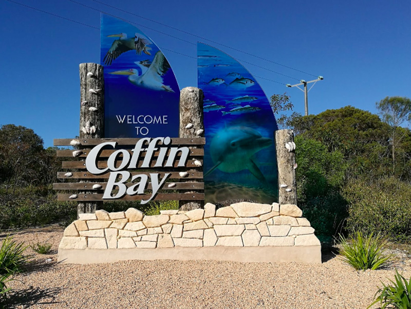
- Coffin Bay
Visit Murphys Haystacks & Pildappa Rock, then stay over in Coffin Bay. Another trip is to drive to Lake Gairdner and then stay in Coffin Bay. It’s too far from that lake, but it is still worth visiting a fantastic attraction, go for it if you like, as long as you would like to drive more hours.
Day 12 – Coffin Bay to Port Lincoln
- Estimated Distance – 76.7 km
- Estimated Drive Time – 1 hr 12 min
>>Get Navigation on Google Map
In this part route, you have these places drive-through:
- Lincoln National Park
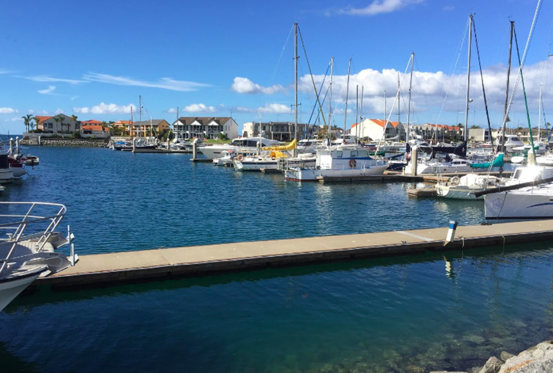
- Port Lincoln
Visit Coffin Bay and Port Lincoln, or Lincoln National Park, and stay in Port Lincoln. These places are famous enough so go for as you want.
Day 13 – Port Lincoln to Kimba
- Estimated Distance – 507 km
- Estimated Drive Time – 14 hr
>>Get Navigation on Google Map
In this part route, you have these places drive-through:
- Kimba
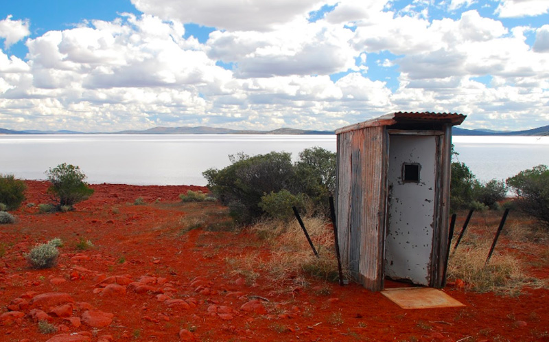
- Lake Gairdner
Leave Port Lincoln, visit Lake Gairdner, and stay over at Kimba. Or you can ignore this lake and turn to Port Augusta. It’s OK because it’s been such a long hard time (over 12 hrs) drive from Port Lincoln to the lake.
Day 14 – Kimba to Adelaide
- Estimated Distance – 463 km
- Estimated Drive Time – 5 hr
>>Get Navigation on Google Map
In this part route, you have these places drive-through:
- Port Augusta
- Adelaide City
Leave Kimba, rest at Port Augusta, finally arrive at Adelaide City, road trip accomplished.
Want to know more attractions?
Check Over 32 Up Attractions between Perth & Adelaide>>
Conclusion
I hope you enjoy this road trip, and you already know the best route between Perth and Adelaide. Now, get your belongings ready, get food and a map, turn on your car engine and start it!
By the way, besides the Perth Adelaide trip planner, I recommend these route planners for your next road trip:
You May Also Need:
Want More Attractions for Your Road Trip?
32+ Attractions between Perth & Adelaide Australia
Are You Looking for Job? Here’s Your Jobs List
- 19+ Farm Hand Works in South Australia
- 9+ Farm Hand Works in Western Australia
- 6+ Meat Works in South Australia
- 6+ Meat Works in Western Australia
- 7+ Seafood Works in South Australia
- 6+ Seafood Works in Western Australia
Some Tools Help Your Road Trip
Read This Australia Guide Book Now to Get More Beautiful Attractions and Plan Your Next Road Trip!
By Lonely Planet. This book introduces the amazing 39 best road trips for visitors who wanna touch beautiful places with night galaxy camping. Cleary descriptions cover all locations: Sydney, Melbourne, Brisbane, Cairns, Perth, Darwin, Uluru, Tasmania & others in the state of Australia. Full-color photography with prominent text trip guides. You can order a paper version to carry on with you or download a Kindle version via Amazon online store. Read more detail>>
Don’t Forget to Pick Up This Paper Map with You!
National Geographic created it. Unique paper maps for most visitors who come to Australia need to know where the next place to go. Each route’s detail shows the best places, best lookouts, camping areas, best ways, certain motorways & unseal roads. This map for that traveler who plans outback without mobile service is this paper map you need! Read more>>